Farmland
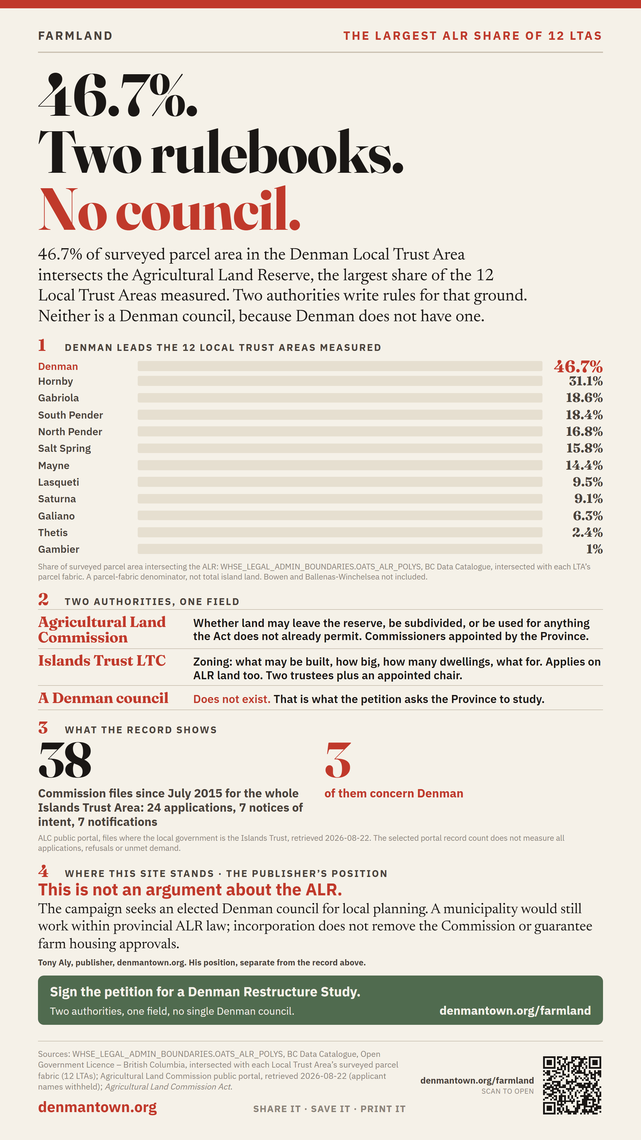
46.7% of surveyed parcel area intersects the ALR.
46.7% of surveyed parcel area in the Denman Local Trust Area intersects the Agricultural Land Reserve — the largest share among the 12 LTAs measured. Two land-use authorities write rules for that same ground. Neither of them is a Denman council, because Denman does not have one.
Denman leads the 12 Local Trust Areas measured
Share of surveyed parcel area intersecting the Agricultural Land Reserve, measured against the Province's ALR boundary. This is a parcel-fabric denominator, not total island land.
Source: WHSE_LEGAL_ADMIN_BOUNDARIES.OATS_ALR_POLYS, BC Data Catalogue, Open Government Licence — British Columbia, intersected with each LTA's surveyed parcel fabric. Comparison set: 12 LTAs. Bowen Island and Ballenas-Winchelsea were not included.
Two authorities, one field
If you farm on ALR land on Denman, or want to, two separate authorities have a say in what you may do with the same acre — and they were created for different reasons, by different statutes, answering to different people.
| Authority | What it controls | Who elects it |
|---|---|---|
| Agricultural Land Commission | Whether land may leave the reserve, be subdivided, or be used for anything the Agricultural Land Commission Act and its regulations do not already permit. | Commissioners are appointed by the Province. |
| Islands Trust — Denman Local Trust Committee | Zoning: what may be built, how big, how many dwellings, what a building may be used for. Its bylaws apply on ALR land too. | Two locally elected trustees, plus an Executive Committee member appointed by the Trust Council chair. |
| A Denman council | Could exercise municipal land-use powers under a structure established by the Province, while provincial ALR law would still apply. | Does not exist. That is what the petition asks the Province to study. |
Depending on the proposal, a farmer may need both provincial ALR approval and compliance with local zoning. A yes from one authority is not necessarily a yes from the other, and a municipal council would still have to work within provincial ALR law. Incorporation would not remove the Commission or promise a single approval.
What the record shows
The Commission publishes a searchable register of its files. This project's search filtered to records listing Islands Trust as the local government returned 38 files since July 2015: 24 applications, 7 notices of intent, and 7 notifications as of 22 August 2026. Three of them concern Denman. This search is not a complete count of every application geographically within the Trust Area; records indexed under another local government may not appear in this result.
That is a small number against this measured ALR share, and it cuts both ways. It can mean the system is working quietly. It can also mean people stopped asking. We are not going to pretend to know which from a file count, and this page will not claim otherwise.
Source: Agricultural Land Commission public portal, files where the local government is the Islands Trust, retrieved 2026-08-22. The portal returns submissions created from July 2015 onward; earlier decisions are not in it and must be requested from the Commission. Applicant names are withheld here.
This is not an argument about the ALR
Plenty of people on Denman want the reserve exactly as it is, and some of them have signed this petition. Farmland protection is not what is being questioned here.
The question is that 46.7% of surveyed parcel area intersects a provincial reserve while local zoning is administered through the Trust, and Denman has no single council accountable for the whole local-government picture. That is true whichever way you would vote on the ALR itself — which is exactly why it is a structural problem and not a political one.